

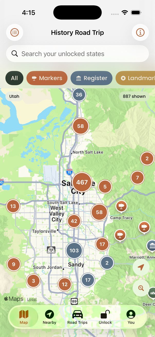
History Road Trip puts every roadside historical marker, ghost town and National Register site in the country on one map, with a short description and a photo for most of them, so you can see what is down that side road before you take it. It covers all 50 states and Washington, DC: about 104,000 places, plus 118 road trip routes strung together from them.
Coming soon to the App Store for iPhone (iOS 17 or later). Free to download, with one-time state unlocks. There is no Android version yet.
Why I built it
I drive a lot. Between Colorado, Wyoming and the North Carolina coast there are a great many brown signs, and for years I passed most of them wondering what they were. When I did stop, it was often the best part of the day: an empty mining camp at the end of a dirt road, a marker for a stage station where there is nothing now but sagebrush, a courthouse square in a town I had never heard of.
The information exists. The National Park Service keeps a list of every historic place in the country and the USGS keeps a list of every town that isn’t there anymore. It just isn’t anywhere you can use from the driver’s seat. So I put it on a map, added what Wikipedia knows about each place, and wrote some road trips through the parts I know. It is the app I wanted for the drives I was already doing.
I’m an SEO and content writer by trade, not a programmer. This is my second app. I built it in the van and I test it on the road.
What it does
- A map of 104,000 historical markers, National Register sites, National Historic Landmarks, ghost towns and museums, with filters by type
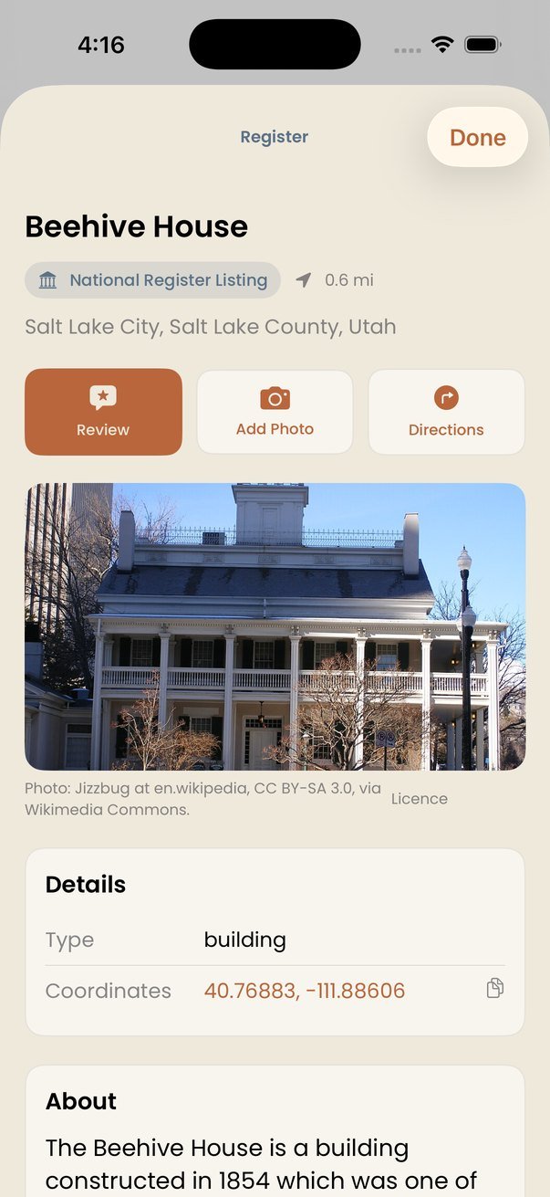
- A short description and a photo for most places, so you can decide whether it is worth the detour
- Directions in Apple Maps, Google Maps, Waze or Gaia GPS, and coordinates you can copy with one tap
- Reviews from other travelers: whether the marker is still standing, where to park, whether the road is passable
- 118 road trips, two for every state, each made of real places from the map
- Everything works with no signal. The place data is on your phone.
What’s free and what isn’t
The free version isn’t a demo. Anywhere in the country, everything within 25 miles of you is fully open: the map, the place pages, directions, reviews, and one road trip in every state. If you are standing somewhere, you can see what is around you.
Unlocking opens a whole state wherever you are: every place, search, and all of its road trips. When you reach the edge of the free radius the app offers three things. That state, for a one-time $3.99 (a few smaller states are $2.99, and Texas, with 16,000 official markers, is $4.99). Its region, four to seven states for $9.99. Or every state for $24.99, which includes any state added later. None of these are subscriptions, and you can keep using it free nearby for as long as you like.
Reviews and photos are free everywhere. The only subscription in the app is $1.99 a month for unlimited photo uploads, because storing photos is the one thing that costs me money every month. The first 20 photos a month are free, which is plenty for most trips.
Where the data comes from
All of it is public record. The National Park Service’s National Register of Historic Places and National Historic Landmarks, the USGS Geographic Names Information System for former settlements, and state marker programs in Utah, Idaho, Montana, Texas and Arkansas. Descriptions come from Wikipedia and are used under the Creative Commons Attribution-ShareAlike 4.0 licence. Photos come from Wikimedia Commons and each one shows its photographer and licence in the app.
Archaeological sites are deliberately left out. Publishing their locations leads to looting, and the agencies that hold them keep them restricted for good reason.
Privacy
You can use the map without an account and nothing about you leaves your phone. An account is needed only to post reviews or photos, which are public under a display name you choose. There is no advertising, no analytics and no tracking. The full privacy policy is here.
Questions or bugs
Email me at tee@teecorleytravels.com. I read everything. If a place is in the wrong spot, a marker is gone, or a road trip needs a better stop, I would like to know. Tell me the place name and the state and I can find it.
If you want to delete your account, you can do it from the You tab inside the app, or email me and I will do it for you.